Showing posts with label Post code. Show all posts

Sunday, May 29, 2016

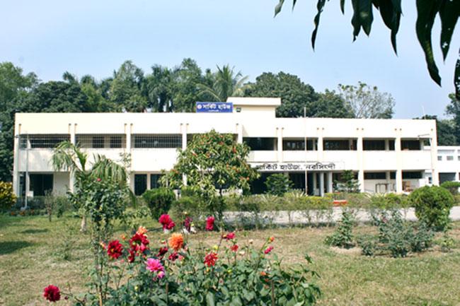
Google Map And Post Code Of Shibpur Narshingdi

Shibpur (Bengali: শিবপুর) is an Upazila of Narsingdi District in the Division of Dhaka, Bangladesh.Shibpur is located at 24.3750°N 90.7375°E. It has 44365 households and total area 206.89 km².
Shibpur Narshingdi Wikipedia:
Area NamePost office
Post Code
ShibpurShibpur
1620
Shibpur Narshingdi Map:
Shibpur Narshingdi Local Area Name:
Boilab, DakshinSadharchar, Dulalpur, Duttergaon, Ekduria, Khayra, Satpara, Shakarchar, Shibpur  UPO.

Google Map Of Narshingdi Sadar

Narsingdi Sadar (Bengali: নরসিংদি সদর) is an Upazila of Narsingdi District in the Division of Dhaka, Bangladesh.Narsingdi Sadar is located at 23.9167°N 90.7250°E . It has 81780 households and total area 213.44 km².
 Narshingdi Sadar Wikipedia :
Area Name
Post office
Post Code
 

Narshingdi Sadar

Karimpur
1605
Madhabdi
1604
Narshingdi College
1602
Narshingdi Sadar
1600
Narshingdi Sadar Area Map:
Narshingdi Sadar Area Name:
Adiabad, Alokbali, Amadia, Balusair, Charsubudir, Chinbalapur, Gutiabari, Hairmara, Karabuchar, Karimpur UPO, Kumradi, Madhabdi SO, Maheswardi Pachgaon, NarsingdiCollegeSO, Nilaksha, Noadia, Noagaon, Noapara, Panchabati, Panchdona SO, Rahimabad, Satgram, ShekherChar, Shibmandir, Vatipara.

Wednesday, May 25, 2016

Population Census And Others Information Of Narsingdi District

Narsingdi Sadar Upazila (narsingdi district) area 213.44 sq km, located in between 23°46' and 23°58' north latitudes and in between 90°36' and 92°50' east longitudes. It is bounded by palash, shibpur and raipura upazilas on the north, araihazar upazila on the south, bancHharampur and Raipura upazilas on the east, Palash and rupganj upazilas on the west.
Population Total 578563; male 304643, female 273920; Muslim 532854, Hindu 45460, Buddhist 93, Christian 60 and others 96.
Water bodies Main river: meghna.
Administration Narsingdi 'Thana, now an upazila, was formed in 1930. Narsingdi Municipality was formed in 1972.

Elected MP And Parliament Election Winner Information

Profile
Narsingdi district was a subdivision under greater Dhaka district and was turned into a district in 1984. The district consists of 6 upazilas, 3 municipalities, 27 wards, 55 mahallas, 69 union parishads, 652 mouzas, 1060 villages.
Upazilla/ Thana
Belabo Upazila, Monohardi Upazila, Narsingdi Sadar Upazila, Palash Upazila, Raipura Upazila, Shibpur Upazila
Area1140.76 square kilometers.
Bounded by
Kishoreganj district on the north, Narayanganj and Brahmanbaria districts on the south, Brahmanbaria and Kishoreganj districts on the east, Gazipur district on the west.

Tuesday, May 24, 2016

Post Codes For Narsingdi District

Thana/Upazila within Narsingdi District are: Belabo, Monohordi, Narsingdi Sadar, Palash, Raypura. The following table contains post codes of various sub post office in Narsingdi district.

Real Information Of Shibpur Upazila in Narsingdi District

Shibpur (Bengali: শিবপুর) is an Upazila of Narsingdi District in the Division of Dhaka, Bangladesh. As of the 1991 Bangladesh census, Shibpur has a population of 237246. Males constitute 50.77% of the population, and females 49.23%. This Upazila's eighteen up population is 117487. Shibpur has an average literacy rate of 32.3% (7+ years), and the national average of 32.4% literate.

Actual Information Of Raipura Upazila in Narsingdi District

 Raipura (Bengali: রায়পুরা) is an Upazila of Narsingdi District in the Division of Dhaka,
 Bangladesh. Raipura is located at 23.9667°N 90.8750°E. It has 76508 households and total area of 312.77 square kilometres (120.76 sq mi). At the 1991 census Raipura had a population of 413,766, of which 204,212 were aged 18 or older. Males constituted 51.58% of the population, and females 48.42%. Raipura had an average literacy rate of 22.5% (7+ years), against the national average of 32.4%.Raipura has 24 Unions/Wards, 114 Mauzas/Mahallas, and 231 villages.

Overall Information Of Palash Upazila In Narsingdi District

Palash (Bengali: পলাশ) is an Upazila of Narsingdi District in the Division of Dhaka, Bangladesh.
Geography
Palash is located at 23.9500°N 90.6250°E . It has 31350 households and total area 94.43 km².
Demographics
According to the official 1991 census, Palash had a population of 174,040. Males constitute 53.4% of the population, and females 46.6%. This Upazila's eighteen up population is 89627. Palash has an average literacy rate of 88.6%  By 2011 that population had grown to 212,612, consisting of 46,780 households.
Administrative
Palash is divided into: 5 Unions/Wards 64 Mauzas/Mahallas 98 villages. This Upazila has a great contribution on the economical and educational aria of Bangladesh. Palash has 22 primary school, 20 high school, 16 colleges, and 2 university. It is one of the richest Upazila in Bangladesh. It has been called the industrial motherland for its strong industrial infrastructure. 28% of industrial product and its raw material of Bangladesh comes from Palash.

Normal Information Of Narsingdi Sadar Upazila In Narsingdi District

Narsingdi Sadar (Bengali: নরসিংদি সদর) is an Upazila of Narsingdi District in the Division of Dhaka, Bangladesh.Narsingdi Sadar is located at 23.9167°N 90.7250°E . It has 81780 households and total area 213.44 km².As of the 1991 Bangladesh census, Narsingdi Sadar has a population of 451335. Males constitute 32.61% of the population, and females 67.39%. This Upazila's eighteen up population is 226885. Narsingdi Sadar has an average literacy rate of 31% (7+ years), and the national average of 32.4% literate. Narsingdi Sadar has 2 paorasava and 14 Unions/Wards, 203 Mauzas/Mahallas, and 270 villages.

General Information Of Monohardi Upazila In Narsingdi District

Monohardi (Bengali: মনোহরদী) is an Upazila of Narsingdi District. in the Division of Dhaka, Bangladesh. Monohardi is located at 24.1278°N 90.7000°E . It has 47397 households and total area 193.87 km². This upazila is located near the Brahmaputra River.

Basic Information Of Belabo Upazila In Narsingdi District

Belabo (Bengali: বেলাবো) is an Upazila of Narsingdi District in the Division of Dhaka, Bangladesh. Here the 2,500-year-old civilisation of Wari Bateshwari has been discovered. It is believed that it was a port city with foreign trade with Rome, Southeast Asia and other regions. It is the oldest city so far discovered after Indus valley civilisation.
Geography
Belabo is located at 24.0917°N 90.8500°E. It has 27802 households and total area 117.66 km².
As of the 1991 Bangladesh census, Belabo has a population of 145708. Males constitute 51.05% of the population, and females 48.95%. This Upazila's eighteen up population is 73046. Belabo has an average literacy rate of 29.9% (7+ years), and the national average of 32.4% literate.
Administrative
Belabo has 8 Unions/72 Wards, 52 Mauzas/Mahallas, and 97 villages. Elected Member of Parliament – Adv. Nurul Majid Mahmud Humayun (Elected – 1986 and also the Present MP elected in the 9th parliamentary election 2008 )Sarder Sakhawat Hossain Bakul (1991 and 2001) and L. G. Nuruddin khan (1996)Adv.Mohammad Shahidullah Bhuyain (1954 M.N.A,1962 M.N.A,1979 M.P,1988 M.P)First Up-Zilla chairman-Abu Tarek Al Hussain Bhuyain.